Pages >>
To Montana, >To Kansas, >To DC, >To Jersey, >To Vermont, >To 50th Reunion, >To Maine, >To Great Lakes, >To Minnesota, >To Glacier Park, >To HomeTo Maine
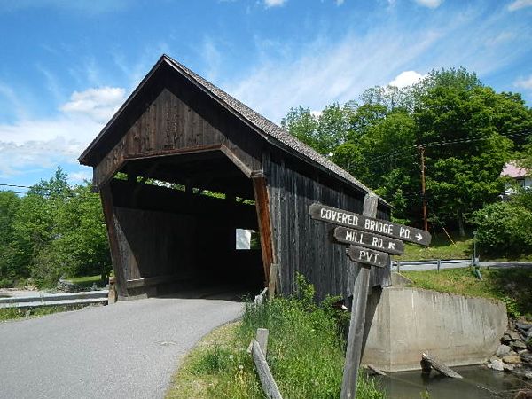
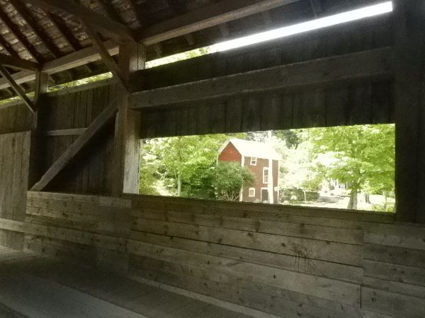
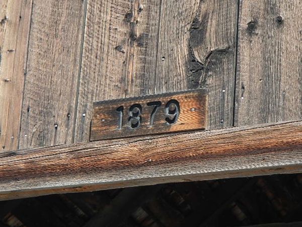
Lincoln Gap Bridge, Warren Vermont
This bridge dates from 1879, when Jim's grandfather was already 4 years old. Covered bridges are not that old. But they are sure picturesque--like so much of Vermont.
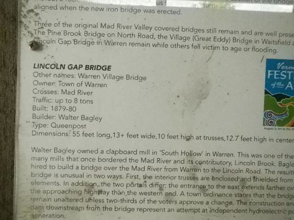
The bridge has a well drawn information plaque describing its history of construction, and re-construction. The main reason for the "covered" is preventive maintenance. I can guess that the brutal Vermont winters have much less result to their onslaught on the very vulnerable uncovered bridge.
From Warren, we headed out north-bound to visit Brad &Ann Caswell, Middlebury friends unable to attend the reunion. We headed east through the town of Brandon and then over the green mountains, partly on dirt roads, to the valley of the Connecticut River.
Finally we found the Caswells on a serpentine Richardson Rd that threaded its way through two more towns and up a suspicious road to a farmhouse where directions could be asked. It was THE house.
Jim caught up old times with Brad. Jim meanwhile made a delicious dinner. After dinner, a hike up old roads through the Vermont woods took us to an overlook where the Connecticut River Valley nestled in the haze.
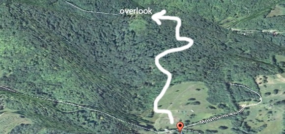
Walk to the top of the hill with a view of the Champlain river valley
The next day we headed to Brad and Ann's summer cabin on Lake Armington. A northern loon rocked on the water. We had lunch, then Jim and Di sailed the Caswell's little 1-3 person Sunfish sailboat. Jim did his usual pitiful jibe, but recovered before we headed down to Davy Jones. Saw a moose, only one on this trip, on the hour-long trip back to the homestead. Jim made dinner again, a delicious stir-fry. Plan to leave soon after breakfast for Maine & mountain climbing.
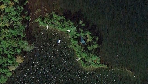
A very secluded island in Lake Armington, New Hampshire
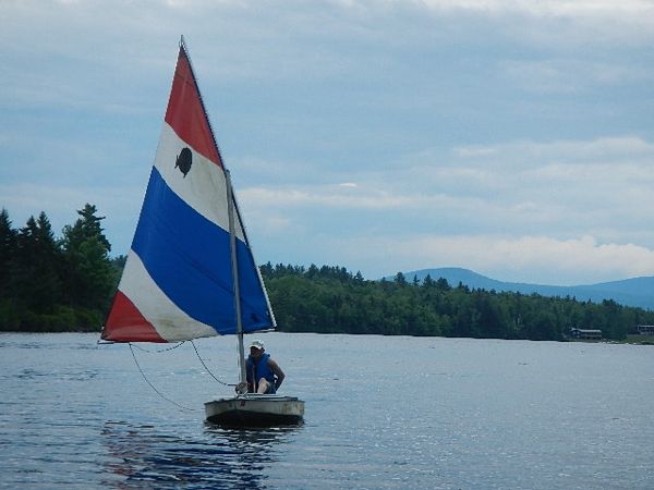
Sailing in a Sunfish on Lake Armington, New Hampshire
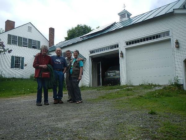
Ann, Brad, Jim and Dianne posing in front of attached (typically Vermont style) garage/barn. Note the solar collector.
June 10: Packed up gear & loaded car; breakfast with Brad & Ann Caswell. Left about 9 a.m. for New Hampshire & Maine to find a mountain or two to climb.
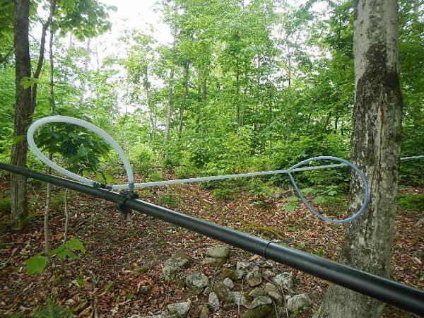
Alongside the road we found new (to us) techniques being used to tap maple trees for their sap to make syrup.
From Vermont we drove South and East through New Hampshire mostly on Highways 18 and 16. Stopped in a small town to get some cash and a bit of food. Ate lunch from the chuckbox. Drove into White Mt. State Forest to stay tonight at Pinkham Notch (ski area) Appalachian Mt. Club & hike tomorrow to the summit of Mt. Washington. We'll get an early night tonight and an early start tomorrow.
June 11: Climbed Mt Washington:
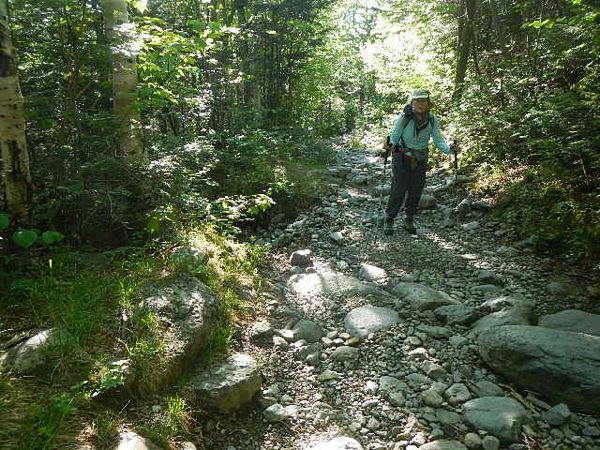
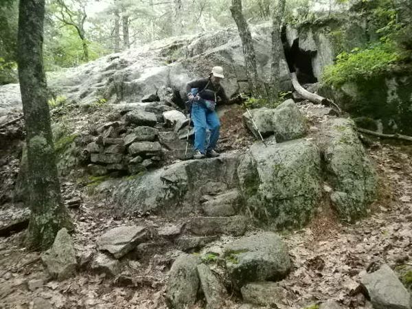
Up before 6 to get packed; on the trail by 6:30. Rough terrain made it a scramble all the way. We started on the Tuckerman Ravine Trail, ascending almost two miles (about 2,000 ft elevation gain) on a trail that for about 6 months of the year is covered in deep snow atop rocks the size of basketballs, and the occasional beach ball. We likened it to scrambling a dry stream bed. We used hiking poles to help our balance. The next two miles on the Lion's Head Trail, another 2000 feet elevation gain, we traversed on steep gneiss or schist boulders, what the Scramblers would call "strenuous."
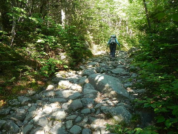
The Lions Head "trail". This is a pile of rocks masquerading as a trail.
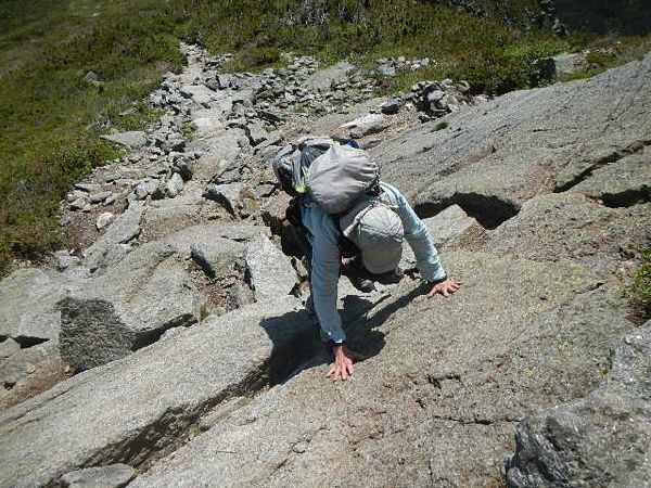
Here the trail gains a serious angle that could not be ascended by any mule--except Dianne.
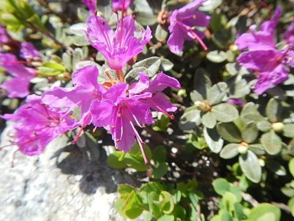
Flowers near the summit rewarded our expenditure of calories.
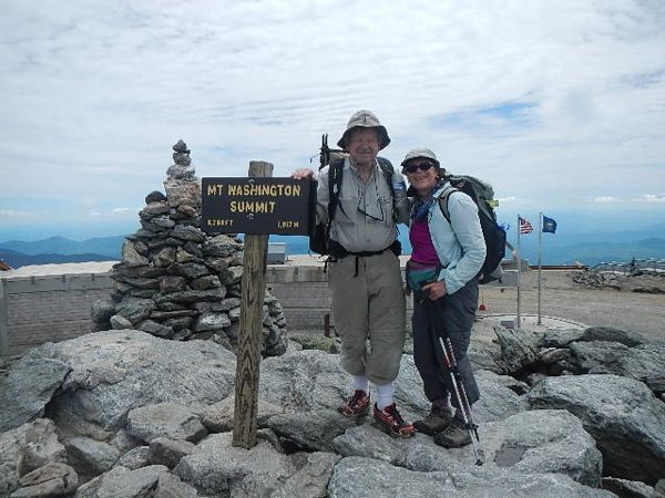
By the time we reached the summit, Dianne was exhausted and we elected to ride down in a van. Whew! We were dropped off at the Appalachian Mt Club Pinkham Lodge, crawled into our comfortable Forester and headed north. Jim had made reservations for us to hike Mt. Katahdin in northern Maine the next day, but it was 3:00 pm, the weather report looked wet and windy, and we were both tired, so we decided to postpone Kahtahdin and head toward the Maine Coast. We aimed for Searsport, on Penbscot Bay east of Augusta. On the way, we stopped to camp overnight at Lk. St. George State Park.
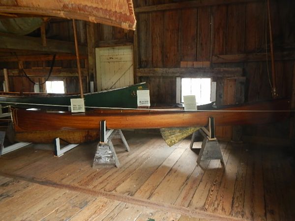
June 12: The next morning we left early for Searsport, where we found the Penobscot Maritime Museum, which focuses on the history of the town from the 1700's, boats, and the fishing industry. We spent a couple of hours learning about the importance of fishing and boating in the town.
We continued to Castine, which had been occupied by the British in the 1800's. In 1812 a collection of land and sea expeditionary U.S. forces sent by Massachusetts attempted to drive the British out of Castine. They failed, reportedly due to poor planning and coordination, as well as insufficient and incompetent leadership. The British set fire to the town and destroyed it. It has since been rebuilt into a very pleasant town.
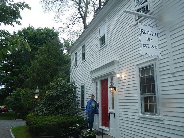
That night we stayed at Blue Hill Inn in Blue Hill, Maine.
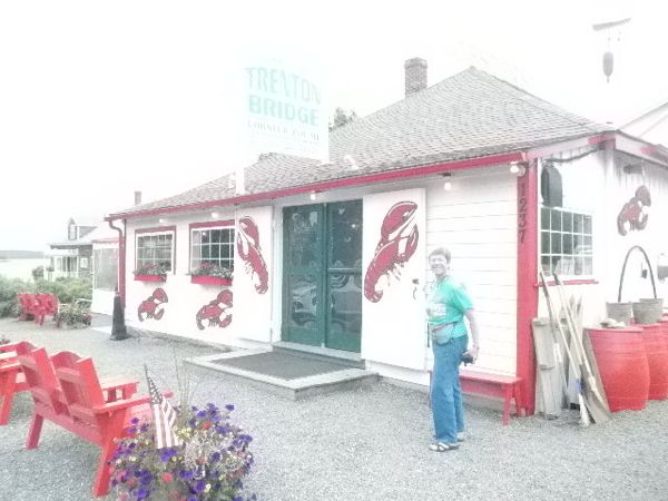
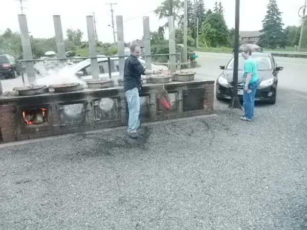
June 13: Up for breakfast and met a couple of other guests. They had a friend from the town who took us on a tour of an art gallery that he helped manage. It was his friend's home. Said friend was absent. There were hundreds of paintings for sale, mostly of landscapes and still life. We did not buy one. He also recommended some nearby eateries for lunch, one of which was Trenton Bridge, see below. We enjoyed their lobster dishes very much.
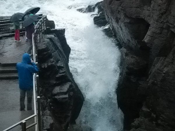
It started to rain as we headed toward Acadia National Park. Jim was interested in visiting "Thunder Hole," a blowhole where incoming waves make a booming sound in a hole or cave in a cliff wall. We drove around the park in the afternoon's heavy rain and visited Thunder Hole before driving on to Bar Harbor.
In Bar Harbor, we checked in at Castlemaine Inn. Hostess gave us list of guest-recommended restaurants. Ate dinner at Finback Alehouse. Jim had steak, Dianne had delicious salad dinner with roast chicken, eggs.
June 14, 2014
Breakfast at Castlemaine Inn. Checked weather re: hiking Kahtahdin. Some possibility of showers today & tomorrow (Sunday). Long discussion of whether we do it, when, where we would stay if we do it on better weather Monday, and which trail to summit: Knife Edge or other trail. Finally decided to book a lean-to at Baxter State Park. Meanwhile we had the car battery on, charging the cooler, and my laptop and i-Pod. Soon ran down the car battery and couldn't start the car. Called AAA. The local rep arrived in 45 minutes.
Started the car promptly; we drove to Mt. Acadia to hike to the summit: 631 ft elevation gain. Took a couple of hours, plus conversation with other hikers. Trail was mostly steep, scramble terrain. Rock was somewhat wet from Thursday's rain, so had to be careful with foot placement.
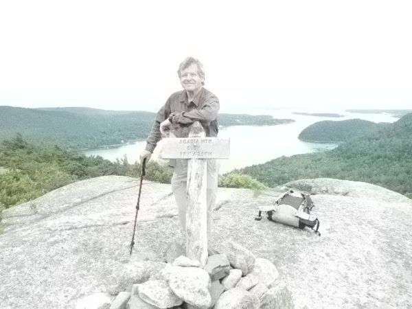
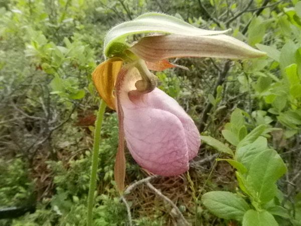
Ladies Slipper orchid on Cadillac mountain.,
More Cadillac mountain hiking.
June 15, 2014 Bar Harbor, Maine
Woke up in Robbins Motel, showered, packed, Jim couldn't find his glasses that he thought he had with him on yesterday's hike of Mt. Acadia. He was pretty sure he had lost them on the mountain. To be sure, he called the Castlemaine Inn where we had stayed Friday night. They had not found them. He tried last night's restaurant, but they were not open. He decided he would hike the mountain again to search for the glasses before going up to Baxter State Park, where we will stay tonight and be hiking Mt. Kahtahdin on Monday. (See Kahtahdin's Knife Edge Ridge in photo below.)
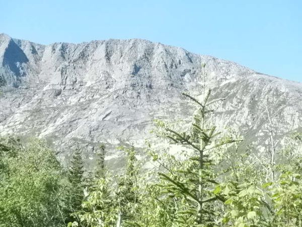
View of the cirque of Mt. Katahdin. The glacial ice chewed away some not-so-hard granite.
June 16, 2014
Up at 5:00 am in $11/person bunk room. Packed away the sleeping bag and Therma-Rest in the Rocket box, put packs on our back, and grabbed our poles. We signed the Today's Hikers sheet that they use to track those who head up the mountain. There is another tracking sheet about halfway up, but no signup at the top. We started up the trail, what we thought might be the easiest trail, but discovered to our dismay that the trail was jammed with rocks as big as baseballs, basketballs, giant beach balls. As we ascended the trail, the boulders got bigger and the dirt floor between got smaller. The trail to the summit was 5.5 miles, 5,267 ft. elevation gain, and took us 6 hours to reach the summit (confession: it included a few conversations with fellow hikers).
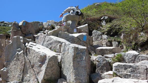
In the East, they call this a "trail" up the mountain. This does not look like the Pacific Crest Trail, or paths in the Cascades or Rocky Mountains. We did appreciate the blue trail markers.
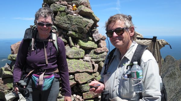
We hung out at the summit for a half hour, chatting with other hikers, and trying to decide if we would take the narrow "The Knife Edge" trail (see above) that followed the crest for a mile before heading down a boulder-covered ridge. We considered the gusting wind, weather, steepness of terrain, and risk of falling, and decided the route we had ascended was the better choice. We took five hours to descend. We were very tired, but pleased to have accomplished the famous East Coast climb. We returned to Millinocket, ME, and Baxter Park Inn for a very welcome shower and a comfortable night's sleep.
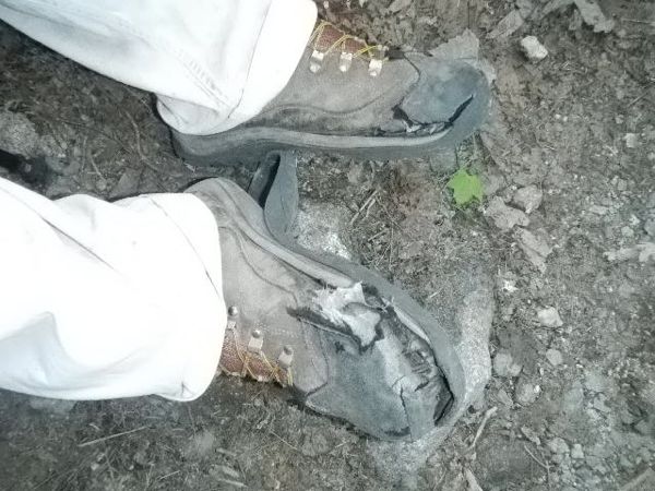
On the way down we met these boots on the father of a much younger hiker. Perhaps this is carrying pusillanimity a little too far?
From here we headed to the coast of Maine for some lobster, sunshine, and the impetus to start heading home.
 Back Next